
I have a Putnam-centric view in running this website. What that means is not all the destinations showcased on this website are IN Putnam, but they are all conveniently located for someone that lives in Putnam County, NY. Today’s featured hike fits in that category.
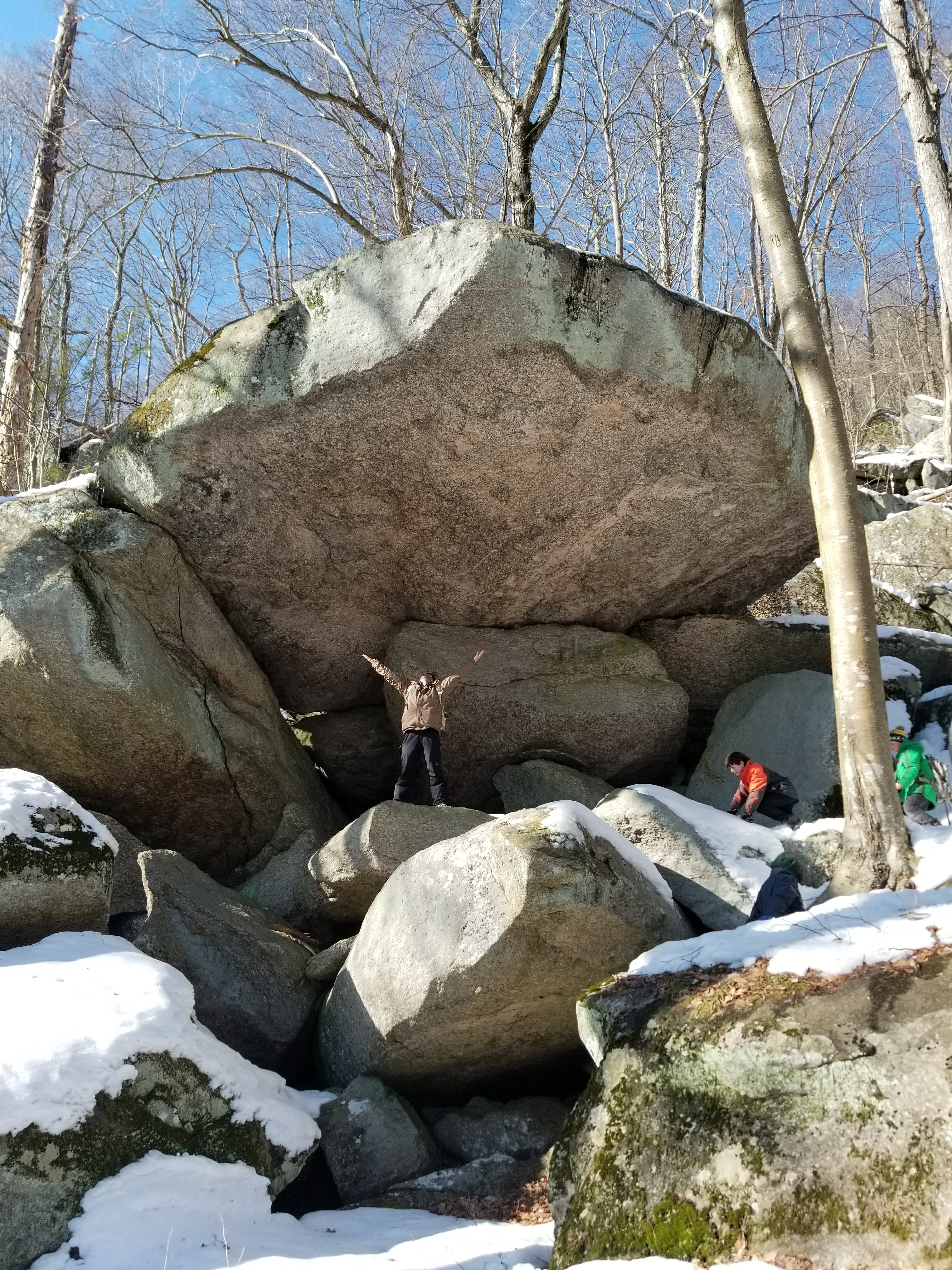
A little into Connecticut is the Squantz Pond State Park section of Pootatuck State Forest. There are some GREAT trails here with a number of beautiful spots, including views down onto Squantz Pond, as well as Council Rock – an awesome rock formation that was used by Chief Squantz (hence the name of the park) of the Schaghiticoke Tribe in the early 1700’s for signal fires and meetings.
Be warned that the parking lot we started from was at the top-end of the elevation of the park, so on our five mile hike we spent the first half heading steadily downhill – and the second half getting a great leg and cardio workout on the way back up.
We drove to the Pine Crest Lane parking area. Coming from the Patterson/Brewster area, I found the best way to get there was take Haviland Hollow Rd from Route 22 (near the Putnam Diner). Go 2.7 miles to Route 37 and turn right at the fork in the road onto Route 37 to head south. Go 1.7 miles. Turn left onto Pine Hill Road and go another 1.7 miles, then turn right onto Pinecrest Road. Pinecrest Road will turn right to head downhill to a cul-de-sac, but you want to continue straight into the parking area. It is not very well marked.
We did a clockwise loop. Starting at the parking lot we veered left down the Forest/CCC Road, made a left into the White Trail, then a right onto the Red Trail, another right to get back on the Forest/CCC Road, a left onto the Yellow Trail, then straight to take a .25 mile unblazed trail, then a left onto the Orange Trail to bring us back to the parking lot. The trail map said our hike was going to be 3.65 miles, but my Fitbit said it was just over 5 miles, so plan accordingly.
The old Forest Road is wide and clear. The Red Trail was more difficlut, but to me was the most spectacular portion of the hike – Council Rock is impressive, and the other rock formations along the trail are really nice.
The Yellow Trail had not been visited in a while, so we were slogging through the snow. Smartly, I put my in-shape 15 year old in front of me to blaze some footprints to step in.
The Blue Trail (which we didn’t take this time, but we have done in the past) has two great viewpoints looking down onto the Squantz Pond beach.
I’d highly recommend bringing lunch with you, as well as a good supply of water. Our hike took us three hours.
A PDF trail map is available here: http://www.ct.gov/deep/lib/deep/stateparks/maps/squantzpond.pdf


Sources:
Personal Visits. Various dates.
http://i95rock.com/squantz-pond-rich-with-history/ Accessed 3/19/18.
http://www.ct.gov/deep/cwp/view.asp?a=2716&q=325268&deepNav_GID=1650%20#map Accessed various dates.